Cycling in Andalucía, Spain: Part 2

Stage 3 - Colmenar to Antequera
This is the continuation of our cycling journey from Cycling Andalucía, Spain - Part 1.
Start Colmenar
Finish Antequera
Distance 52km
Climbing 1,342m
Grade Hard
This day proved to be the most challenging day of riding that I've ever experienced – bar none. Unfortunately, Nadiah caught a slight cold and wasn't feeling well, so she opted to take a vehicle transfer to the next town. That pretty meant that I had to do this particular stage solo! In hindsight though, perhaps it wasn't that unfortunate for her since she got to spend her morning in a jacuzzi.
After breakfast and leaving the inn at Colmenar, I met my first climb almost immediately. Following the quiet road out of the village, I made my way past the pueblo blancos of Colmenar and entered the beautiful and panoramic landscapes that I’ve come to love. There were plenty of rolling hills along the way, along with two climbs averaging at a gradient of 9 percent.
The next checkpoint after Colmenar was Villaneuva de la Concepcion, a beautiful small town in the hills and described in Spanish as al pie del Torcal, or at the foot of El Torcal. After the rolling hills and two climbs from my first 20km of the morning, it was wonderful to see a beautiful descent heading towards the town. But of course, the descent ended quickly, and it was back to climbing!
And climbed back up I did. After a fast descent into the valley right before the start of town, I took a break by the road to prep my legs for what would be the most arduous day of climbing ahead of me. I sat there by the road, leaning against the rocky landscape and watched the cars drive by. I could hear the changing thrum of the engines as the cars switched gears going up the hilly road. And they kept going up, and up...
It was a wonderfully brutal climb heading into Villaneuva de la Concepcion, but there it was at last! And of course, even after I arrived at the town borders, the road still continued to climb upwards. In fact, the entire town was pretty much an upward slope that would wind all the way to El Torcal. I took a few breaks as I passed through town, admiring the quaint architectural style that is prevalent throughout Andalucia, and to obviously catch my breath.
Upon reaching the top half of town, my prayers for water were answered. At this point, I have already gone through two liters of water from all the climbing I did earlier. A water fountain with fresh spring water waited for me at the town plaza at the top of the hill (why does it ALWAYS have to be at the top of a hill) and I refilled all my water bottles to my heart's content. I vaguely recalled a choir of angels singing around me, or it could just be that I was delirious and needed water.
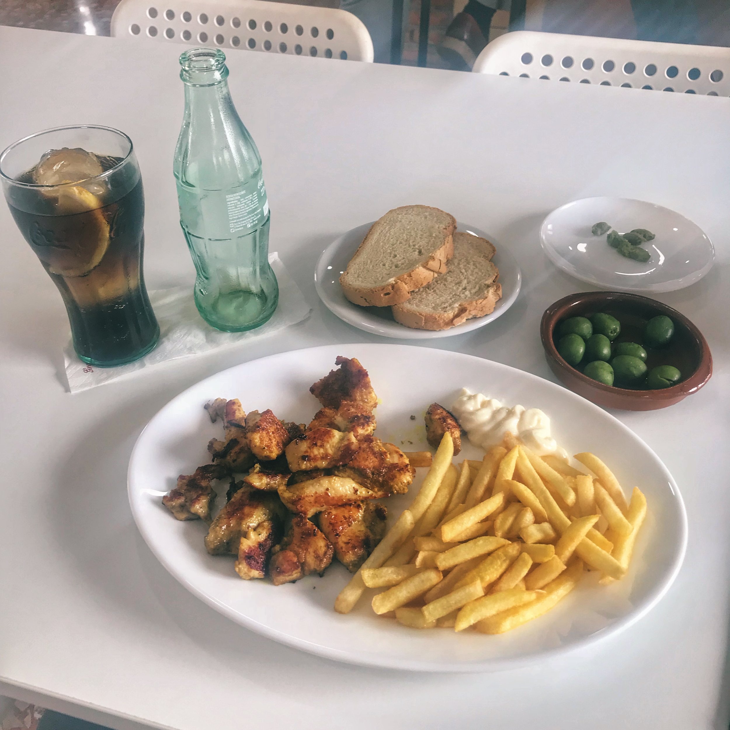
I was also starving and needed to load up on calories before continuing my journey. Of course, the row of eateries just had to be further up the hill, so I had to continue climbing. My nose eventually followed the scent of grilled chicken, and I managed to finally sit down and enjoyed a wonderfully simple and tasty meal.
After enjoying a bit of recovery time, my legs were finally able to move again. I bid farewell to the folks at the restaurant and got back on my bike, aiming for the road that would take me up El Torcal. For those that followed the La Vuelta race of 2017, the portion of the route from Colmenar to Antequera for Stage 12 that the pros went through was exactly the same route I'm experiencing at this very moment. And as this is Spain, supporters of Contador left their mark on the roads. It was nice to catch a bit of that on this ride!
After the relentless climb out of Villaneuva de la Concepion, I finally arrived at a very brief flat section at Puenta del Torcal. The flat section lasted all of five minutes, and I stopped at the base of the majestic El Torcal karst formation to contemplate my choices:
Skip the climb up El Torcal and regret it forever
Go kill myself and climb up El Torcal
You can clearly guess which option I went for.
The Sierra del Torcal (or more commonly known as El Torcal) is a mountain range made of unique limestone formations, separating the cities of Antequera and Málaga. Designated as a Natural Site of National Interest in 1929, the El Torcal nature reserve is well known for its unusual landforms and is one of the most impressive karst landscapes in Europe.
It has four geological sections: Sierra Pelada, Torcal Alto, Torcal Bajo and Tajos and Laderas. The highest point in El Torcal is Camorro de las Siete Mesas at an elevation of 1336m in the Torcal Alto. Once I made up my mind to do the El Torcal climb, I was determined to get to the top!
My legs turned to jelly halfway up El Torcal, but I kept moving. I was the only cyclist that day, and there were moments where folks from cars, vans and buses cheered me on. Every time I felt like I was going to die from the relentless climbing, I stopped for a bit of recovery, and a rush of euphoria would pass through me, realizing that I was surrounded by natural beauty as far as the eye could see. I may have reached the edge of my physical limits, but the rewards were extraordinary. Experiencing the landscape of El Torcal with my entire being really felt like I was in another world. The only recognizable life forms that managed to climb the landscapes on their own were the mountain goats!
Once I reached the top, I rewarded myself with ice cream from the cafe at the visitor center, and perched myself on a rock to enjoy the panoramic views from the peak. Around 150 million years ago, this whole area was at the bottom of an ancient sea, and a succession of violent tectonic movements pushed the seabed upwards to form hills and mountains, followed by a few more million years of erosion from wind and rain, sculpting the limestone to become what we now see as the visually spectacular landscape of El Torcal.
A long hard climb to the top of El Torcal has its rewards – a fantastic descent that would bring me all the way to Antequera! The next 20km from the peak of El Torcal was all downhill and I got to experience riding down some fantastic white-knuckled switchbacks!
As I got closer to Antequera, I spotted remnants of old and abandoned farmhouses. I took my time towards the end of the route, not wanting to finish it quite so fast – there was plenty of atmosphere to soak in and I chose to go at a relaxed pace to really enjoy the scenery.
At last I arrived at Antequera, known as el corazón de Andalucía, which translates to "the heart of Andalucia" due to its central location between Malaga, Granada, Cordoba and Seville. As it was a very strategically placed location for trade, the Moors built a stronghold – the old Alcazaba stands proudly on the hill in the middle of town and is visible from afar. And behind in the distance lies the face of a sleeping stone giant, a natural rock formation known as Peña de los Enamorado.
A Day of Rest in Antequera
After three days of long and steep climbs, it felt wonderful to have a day of rest in the beautiful and ancient town of Antequera. Antequera has a very long history dating back to Ancient Roman times and was known back then as Anticaria. Under the Romans, Anticaria was particularly known for the high quality of its olive oil, and I'm quite sure that hasn't change over the past couple of hundred years. After all, the world's supply of olives actually come from this region, even if the bottles are labeled in Italy!
During the fall of the Roman Empire, the area of Anticaria fell to the pagan Siling Vandals in the 410s, who in turn were conquered by the Visigoths and submitted to Visigoth rule in 419. In 716, Anticaria was integrated into the empire of the Umayyad Caliphate and the city then became known as Medina Antaquira. During the Reconquista in 1410, an army led by Prince Ferdinand of Aragon conquered the city and has been known as Antequera ever since.
As we only had a day to explore, we decided to visit two of the most important sites within a short riding distance from our hotel in the center of town: the Alcazaba at the top of the hill, and the ancient Neolithic burial grounds – two historic areas across a huge range of time that describe just how much history this place has.
The Alcazaba of Antequera is a Moorish fortress that was erected in the 14th century to counter the Christian advance from the north. This fortress was built over Roman ruins, and the remnants of an old Visigoth church can also be found within its compounds. From the fortress walls, one could see commanding views of the entire countryside from all angles.

From the central garden courtyard, one could clearly see Peña de los Enamorados which translates to "The Lovers' Rock," named after the legend of two young Moorish lovers from rival clans who threw themselves from the rock while being pursued by the girl's father and his men. The English poet Robert Southey adapted this local romantic legend for his Laila and Manuel, in which the lovers were a Muslim girl and her father's Christian slave.

The fortress itself is rectangular in shape and is flanked by two towers, both sides offering splendid views of Antequera. The Torre del homenaje (which means the keep) of the Alcazaba was built in the 15th century during the height of battle between the Muslim and Christian kings, and is considered to be amongst the largest of Moorish al-Andalus. Later in 1582 after the Reconquesta, the addition of the Templete del Papabellotas (bell tower) was added.

Outside the fortress walls stands the Real Colegiata de Santa María la Mayor, recognized as a national monument built in a transition style between the late Gothic and the Renaissance period. The construction of the church started in 1514 and was completed in 1550; the façade of the church used stones from the abandoned Roman town of Singilia Barba, located north of Antequera

On the northern outskirts of the city, there are two Bronze Age burial mounds, also known as dolmens: the Dólmen de Menga and the Dólmen de Viera, dating from the third millennium BCE. They are the largest such structures in Europe and recognized as a UNESCO Word Heritage site.
The larger one, Dólmen de Menga, is 25 meters in diameter and 4 high, and was built with 32 megaliths, the largest single megalith weighing about 180 tons. The main chamber within is hypothesized to be the grave of the ruling families. After completion of the main chamber and the path leading into the center of the dolmen, the stone structure was covered with earth and built up into the hill that exists today. When the grave was opened and examined in the 19th century, archaeologists found the skeletons of several hundred people inside.


In between our exploration, the weather very suddenly gave us a heavy downpour of rain. We were lucky that we weren't in the middle of a long ride that day, so we got to witness the rain from cozy sheltered places. And as quickly as the rain started, it ended with the quick return of sunshine from behind the clouds.

And before we began our journey for the next day, we enjoyed a variety of dishes from a few different places in town. A dish of seafood paella is always a great choice, and different eateries will offer subtly unique styles of paella.

And since you made it all the way to the end of this post, please enjoy our short video compilation for this part of our journey!
Keep going!
For other bike tour ideas, read also:
Cycling Taiwan’s East Rift Valley, Jiufen and Houtong 2019
Firm believer of the N+1 bike axiom. Always in search of the next awesome route.


